Scale Model of the Solar System
The Solar system is a large place and it is very easy to forget this when hearing the occasional news item about exploration in space amongst all the other news. A scale model that represents the actual size of the solar system on a scale that can be appreciated will help show what an amazing feat it is the we can send probes to other planets in the Solar System and beyond.
The Concept
The Solar system model scale is based on using the Hawkins Hill Radome in Wellington to represent the Sun and deriving the scale for the model from the size of the dome compared to the size of the Sun. The advantage of using the Hawkins Hill Radome to represent the Sun is that it is a large spherical structure which is easily visible from a large number of places around the Wellington region. The Civil Air Authority kindly provided us with the exact diameter of the Radome which allowed us to calculate the scale of this model to be 1 metre in the model is the same as 91,000 kilometres in reality.
This scale factor has been used to locate the model orbits of each of the planets around the Radome, and also to calculate the size of the model planets. For instance at this scale Earth is a diameter of approximately 14cm and is located 1.6km from the Radome. The Earth’s moon would be 4cm in diameter and 4.2 metres away from the model Earth. If we could place a location to represent the scale model location of the nearest star to Earth (Proxima Centauri) we would have to put it out beyond the (real) moon in this model. Pluto was left out of the model because of the debate around its status as a planet, and also for practical reasons as the scale location for it was likely to be Mt Hector. Should interest be such that Pluto should be included it is likely that the proposed position on Mt Hector would have a line of sight of the Hawkins Hill Radome.
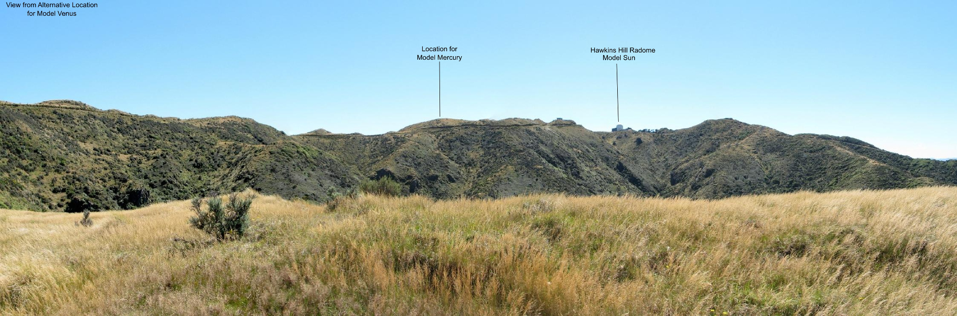
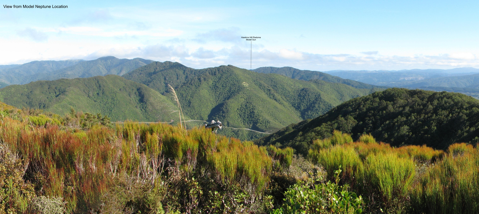
At each location the apparent size of the Radome simulates the size of the sun as it would look from that particular planet. It is also interesting to note that it can also give an idea of how closely the inner solar system is clustered around the sun when viewed from the outer solar system because the spur-line on which the Mercury, Venus, and Earth locations are situated are clearly visible from the proposed locations of the model Saturn, Jupiter, Uranus and Neptune. Views from some of the locations are shown at the end of this page.
For most locations access is by foot or cycle, with the longest journey by foot or cycle being to the proposed location of the model earth which is of the order of 5km along formed roads beyond the Brooklyn Wind Turbine. Only Saturn on the Days Bay Wharf is able to be visited by vehicle.
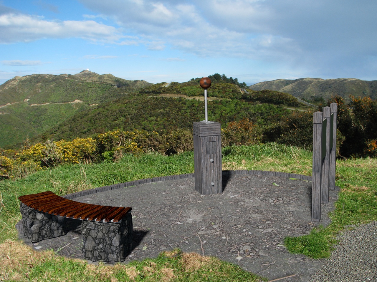
To make this an an educational feature of Wellington beyond just an interesting view it is proposed that each geo-located point used to represent the location of a particular planet in the model have a plinth and representation of the scaled planet and an information board. The information board would have some general information about the planet represented at that location but it would also include information about the planet that relates to features at the model scale such as how far the planet moves along its orbit in a day at the scale of the model (the model Earth would move 28 metres in a day), or how big Mt Everest would be at this scale (0.1mm). To support this and allow people to find the locations, a guide with a map, information about the Solar System, and the GPS locations of each point of interest would be available on a website in much the same way as the Wellington City Council maintains the maps and guides for the Mount Victoria orienteering course.
To make this into quite an attractive science education and art feature for the region the ideal would be to have sculptures at each site that artistically represent the scale planet or encourage local industry to manufacture a spherical structure using the techniques they are skilled at – for example Resene producing a globe from waste paint material, or local metal spinners producing spun metal spheres. We envisage that these could be commissioned from local industry or New Zealand artists or run a design competition. Obviously this increases the scale and cost of the endeavor unless it is local industry contributing their skills and resources to manufacture something.
There are approximately 39 outdoor solar system scale models in existence around the world, but what is proposed here would be one of the largest with the only larger ones being in Sweden, Australia, and one under construction in the United Kingdom. The project proposed here is likely to be the only one of this scale where the structure representing the sun can be seen from the locations of each planet.
These are early days for this project and at this stage we are looking to install some simple geocaches as a geocaching series but we are are seeking interest from various organisations to see if there is the desire to make this into a much bigger thing that can engage more people in science and be an attraction to the region.
A feature like this would have great value to the Wellington region as an Educational Activity that takes people around a good part of the Wellington and Hutt Valley region and gives them an appreciation of the size of our Solar System. In developing this idea we are seeking interest from organisations who are likely to see value in seeing this become a reality and those whose permission will be essential for the installation of the model.
Some “Did You Know” Things
The Outermost Human-Made Objects
On the scale of this model the three most distant objects launched by humans are the two Voyager probes and the Pioneer 10 probe.
On this scale;
- Voyager 1 would be 212km from the Hawkins Hill Radome and traveling at about 16 m/day. That would put it over Hanmer Springs or Waipukurau.
- Voyager 2 would be 175km from the Radome and traveling about 14 m/day. Over Takaka, Patea or Dannevirke.
- Pioneer 10 is assumed to still be traveling and would be around 184km from the Radome and traveling at 11 m/day. Over Mt Travers or Hawera.
The Speed of Light is Slow
The speed of light is 3 x 10⁸m/s which is generally considered to be so fast that it can be thought of as instantaneous. In this model scale the speed of light is just under 12km/h which is jogging speed. This gives an appreciation of how the speed of light affects communication between earth and the various space probes and also observations of events in the greater universe.
Science makes precision throws
The extraordinary feat of getting a Mars lander such as Curiosity to Mars is made very clear when looked at on this scale model. It is like throwing something from the Earth’s model location and landing it gently on top of an object 7.5 cm in diameter on the ridge extending to the North East of the Radome – a distance of 2.7 km away based on the distances at the time of the MSL/Curiosity flight.
Some Pretty Pictures
Higher Resolution Image can be obtained here
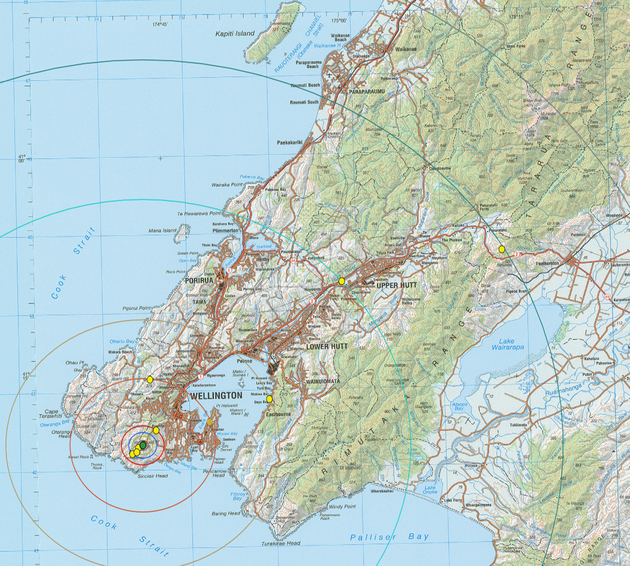
Scale orbits for all of the Solar System planets. The Green circle is the location of the Hawkins Hill Radome. An alternative location for Jupiter at Shelly Bay is also shown.
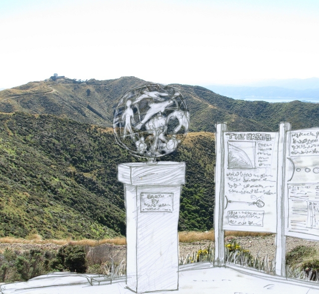
An impression of the geo-location for the Earth model with the Hawkins Hill Radome in the Background.
A computer generated impression of the geo-location for the Mars model with the Hawkins Hill Radome in the Background. You can open a higher resolution image here.
View from the Venus Location
Higher Resolution Image can be obtained here
View from the Earth Location
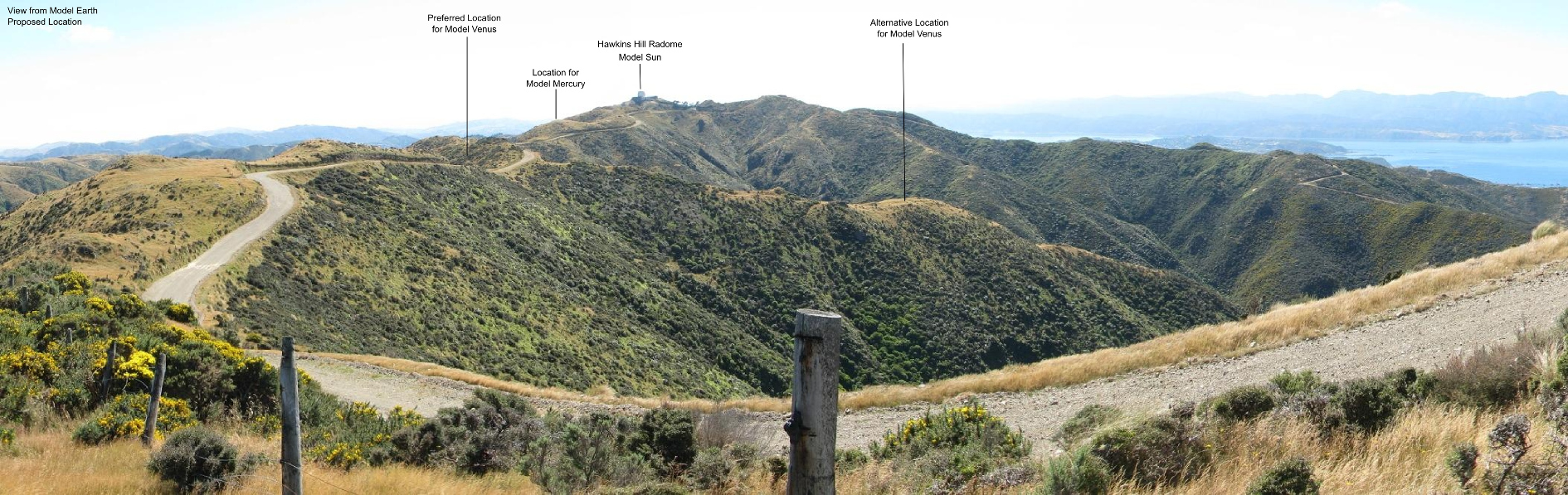
Higher Resolution Image can be obtained here
View from the Jupiter Location
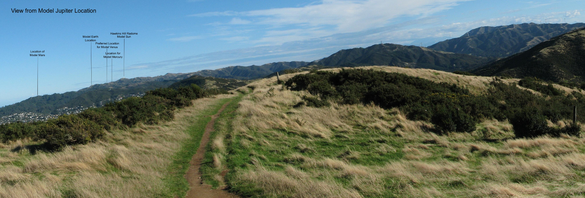
Higher Resolution Image can be obtained here
View from the Saturn Location
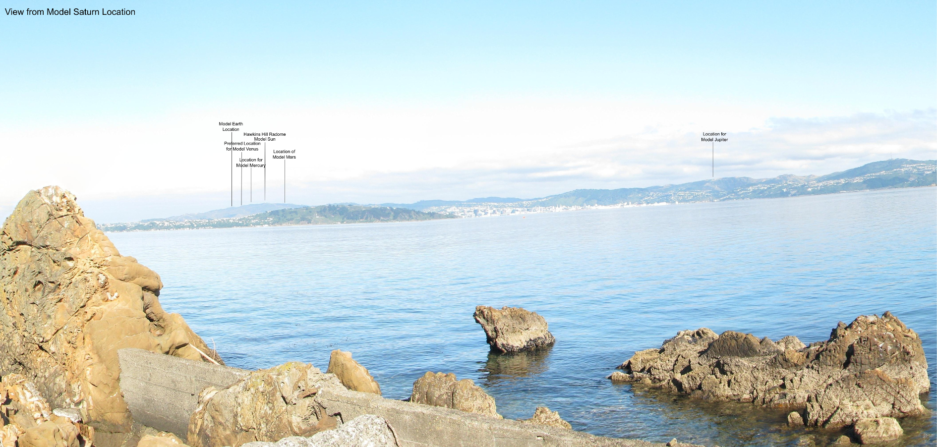
Higher Resolution Image can be obtained here
View from the Uranus Location
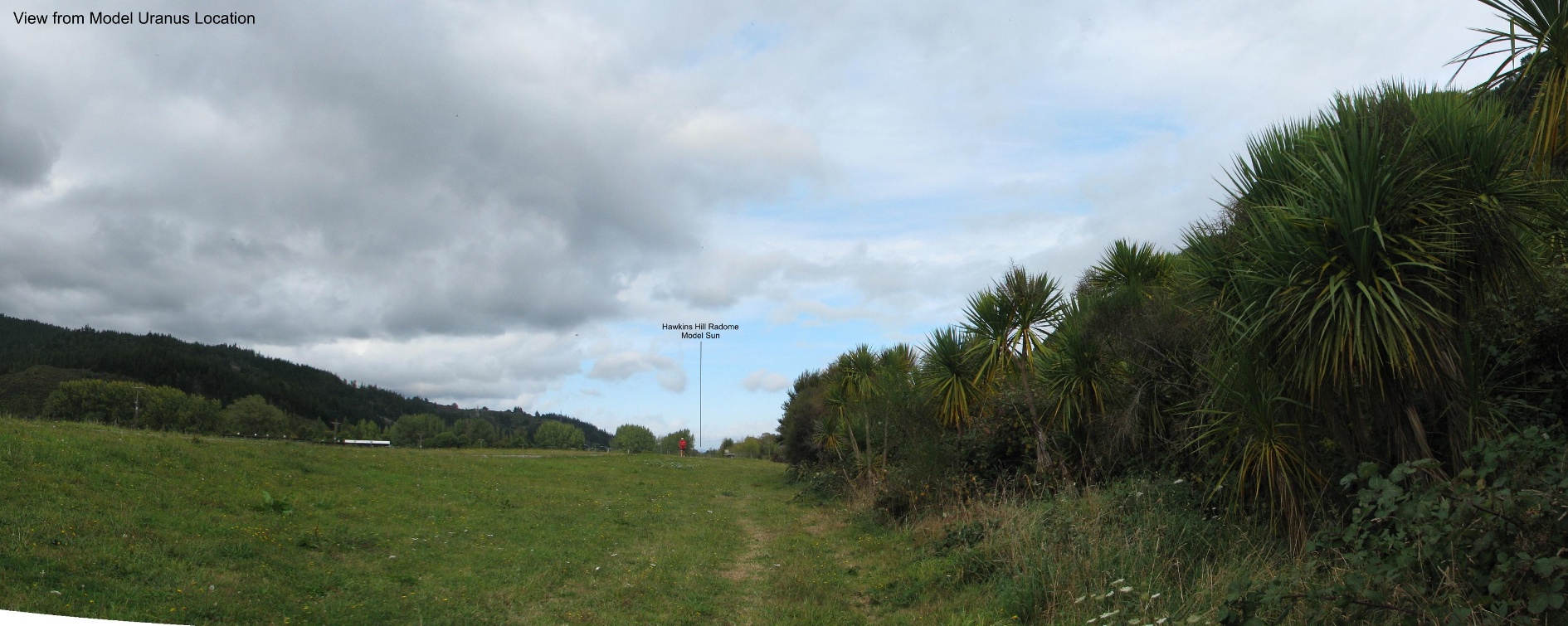
Higher Resolution Image can be obtained here
View from the Neptune Location
Higher Resolution Image can be obtained here